Location Advantage
Tianjin, located in northern China, is a transitional area from the Yanshan Mountains to the coastal plain. It has a total land area of 11,9665 square kilometers, with the mounded plain area accounting for 93%. The highest point is Jiushanding Mountain, with an elevation of 1,078.5 meters above sea level. In contrast, the lowest point is only 3.5 meters, located in the southeast adjacent to the Bohai Bay. Tianjin has a geological history of 2 billion years, featuring
diverse landforms. The Tianjin Jizhou District National Geopark is the only national geoparkin China documenting the geological history of the Middle and Upper Paleozoiceras.

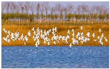
Binhai New Area Beidagang Wetland
The Haihe River, which is 73 kilometers long, meanders through the city and flows into the Bohai Sea. Tianjin's unique geographical location has made it ahub for north-south water transportation for over 1,300 years, from the Sui and Tang dynasties to the Ming and Qing dynasties.
Tianjin is a crucial hub for both land and sea transportation along the "Belt and Road", located at the intersection of the Beiing-Tianjin-Hebei city dluster and the Bohai Sea Rim Economic Circle. It serves as an important seaport for neighboring inland countries. Tianjin Port is the strategic resource and hardcore advantage of Tianjin, with shipping routes to all major ports in the world and the largest liner services operated by the top three global shipping alliances.It is being developed asa"golden node" on the 2Ist Century Maritime Silk Road.

Copyright ©
Tianjin Municipal Government. All rights reserved. Presented by China Daily.
京ICP备13028878号-35


